Blogger news


Monday, November 1, 2010

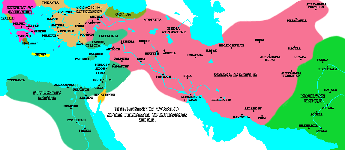
Hellenistic Map

hellenistic map in lycian way


Monday, October 25, 2010

Antalya Travel

Antalya is for the most popular holiday resort of Turkey known. Located in the Mediterranean region, it is a cheap holiday destination that has excellent restaurants, designer shops and other major attractions. It attracts more tourists due to the fact that it is incomparable natural beauty in addition to tourist attraction that will be visited once in a lifetime.


Antalya is one of several beautiful cities of Turkey, which is when the Turkish Riviera because of its clear, blue lakes and long stretches of golden sand considered known. In fact, its exquisite beaches distributed miles away from the hotel. Here, summers are warm throughout. This also makes the oceans warm. The beach view is so spectacular that it is attractive enough to be captured in your camera. Families with young children and those who simply want to relax in the sun many beaches in Antalya that meet their needs. However, the beaches in Antalya is also ideal for enjoying a variety of outdoor water sports. Therefore, those who enjoy water sports like boating admire, can surf and much more.
Wednesday, September 29, 2010

Weather for Antalya tiempo en turquia

You can learn weather for Antalya in this page. Please add your fav. Always updating weather system is F and C Some drizzle, heaviest during Thuesday morning, Warm (max 33°C on Wednesday morning, min 21°C on Frida evening), Wind be generally light


Sunday, September 26, 2010

Lycian Way GPS and waypoints

We went for 9 days along the Lycian Way in May of this year from Ovacik and ends at Myra. Some bits we took a dolmus and some bits we walked sections in reverse order. Hike is from Ovacik to the book and map is not particularly easy. The markers are difficult to detect fairly regularly, some sections were changed due to new agricultural buildings, new roads of villages, landslides, etc. A section, we went in reverse was difficult as it is very difficult to read the thick descriptions in reverse. However, it is still feasible. By the way just about everyone we met Kate's book found less than easy to follow - in fact, too much description and not clear enough route guidance. The card is not large and contains errors. We used a GPS and found it very helpful.


The sections we did not stay out in Kalkan, which was very touristy. We saw very few hikers every day - maybe 1 or 2 days and a total of hikers with whom we do several days in the same met a few - about 6 / 8 people in total on a number of occasions. We did with a man and walked with him for about 3 days which was great especially since it one of the evenings that we were camping included - a longitudinal distance between villages.

Saturday, September 18, 2010

Lycian Way Signs

The Standard Directory of Lycian Way is half white, half red rectangle. There is no uniform distance between the marks along the route when the road start business, to turn and they have become more frequent, and is where the route as a straight line, turning into an easily visible path, then they become less frequent. They are usually painted on the rocks along the route, although you can spot something on utility poles, garden walls, or on the actual path itself.

Side ways lost the main path and usually very arrival in off-the-beaten-path locations (in the literal sense) - Brands Have similar to the standard rectangles replaced only know yellow.

Saturday, September 11, 2010

Maps of Lycia

Information about the Lukka from Penn State

Lycia Locations with modern map

Hellenistic maps f the lycia maps are coming tomorrow :)